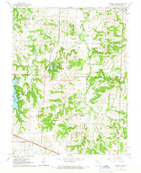
1965 Map of Tarsney Lakes
USGS Topo · Published 1966About this map
Sni-A-Bar Creek and its many forks define this rural landscape on the eastern edge of Jackson County. In the mid-1960s, the area around Tarsney Lakes and Lake Lotawana shows a mix of recreation and long-established agricultural life, with many family-named cemeteries such as Gosney Cem and Koget Cem scattered across the hillsides. The small community of Sni Mills sits at a crossing on the east, while Oak Grove occupies the northeastern corner. Extensive road developments are visible, including a section of highway marked as Under Construction in the southern portion of the map. This survey captures a moment when the region's traditional rural character, anchored by sites like Purdue Chapel Cem and New Liberty Ch, began to intersect with growing regional transportation and residential infrastructure.
Find a feature on this map
33 named features on this map. Tap any name to fly to it.
Don’t see what you’re looking for? This feature index may not catch every label — zoom into the map to look around manually.
Map Details
Editions of this 1965 Tarsney Lakes Map
2 editions found
Other maps of this area

1887 · Harrisonville
USGS Topo · 1:125,000

1892 · Harrisonville
USGS Topo · 1:125,000

1894 · Harrisonville
USGS Topo · 1:125,000

1894 · Independence
USGS Topo · 1:125,000

1933 · Blue Springs
USGS Topo · 1:24,000

1934 · Oak Grove
USGS Topo · 1:24,000

1934 · Woods Chapel
USGS Topo · 1:24,000

1935 · Tarsney
USGS Topo · 1:24,000
1945 · Blue Springs
USGS Topo · 1:24,000
1947 · Blue Springs
USGS Topo · 1:31,680