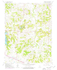
1965 Map of Tarsney Lakes
USGS Topo · Published 1976About this map
Sni-A-Bar Creek and its West Fork define the drainage and settlement patterns of this eastern Jackson County landscape. The 1965 survey, updated with mid-1970s aerial revisions, captures a network of rural family cemeteries that speak to the area's deep genealogical roots, including Purdee Chapel Cem, George Cem, and Alley Cem. Residential and recreational growth is evident around the waters of Lake Lotawana and Tarsney Lakes, where a Fish Hatchery is situated near the western corporate boundary. While Oak Grove marks the northeastern corner of the map, smaller community hubs like Sni Mills and Tarsney anchor the interior. The presence of numerous country churches, such as New Liberty Ch and Sni Mills Ch, illustrates the social fabric of these townships before modern suburban expansion reshaped the region.
Find a feature on this map
34 named features on this map. Tap any name to fly to it.
Don’t see what you’re looking for? This feature index may not catch every label — zoom into the map to look around manually.
Map Details
Editions of this 1965 Tarsney Lakes Map
2 editions found
Other maps of this area

1887 · Harrisonville
USGS Topo · 1:125,000

1892 · Harrisonville
USGS Topo · 1:125,000

1894 · Harrisonville
USGS Topo · 1:125,000

1894 · Independence
USGS Topo · 1:125,000

1933 · Blue Springs
USGS Topo · 1:24,000

1934 · Oak Grove
USGS Topo · 1:24,000

1934 · Woods Chapel
USGS Topo · 1:24,000

1935 · Tarsney
USGS Topo · 1:24,000
1945 · Blue Springs
USGS Topo · 1:24,000
1947 · Blue Springs
USGS Topo · 1:31,680