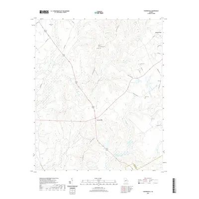
2020 Map of Tarversville
USGS Topo · Published 2020About this map
Tarversville serves as the central hub for this portion of Twiggs County, where the landscape is defined by the dendritic drainage patterns of Richland Cr and Shellstone Cr. The area is notably dense with family and community burial grounds, reflecting deep genealogical roots throughout the rural countryside. These include Beckham Cem, English Cem, New Hope Cem, and Faulk Cem, many of which are located near long-established routes like Old Richland Church Rd.
Find a feature on this map
46 named features on this map. Tap any name to fly to it.
Don’t see what you’re looking for? This feature index may not catch every label — zoom into the map to look around manually.
Map Details
Editions of this 2020 Tarversville Map
This is the sole edition of this map. No revisions or reprints were ever made.
Other maps of this area

1956 · Cochran
USGS Topo · 1:62,500

1956 · Perry
USGS Topo · 1:62,500

1956 · Warner Robins
USGS Topo · 1:62,500

1956 · Jeffersonville
USGS Topo · 1:62,500

1957 · Macon
USGS Topo · 1:250,000

1958 · Macon
USGS Topo · 1:250,000

1964 · Macon
USGS Topo · 1:250,000

1973 · Hayneville
USGS Topo · 1:24,000

1973 · Warner Robins NE
USGS Topo · 1:24,000

1973 · Tarversville
USGS Topo · 1:24,000