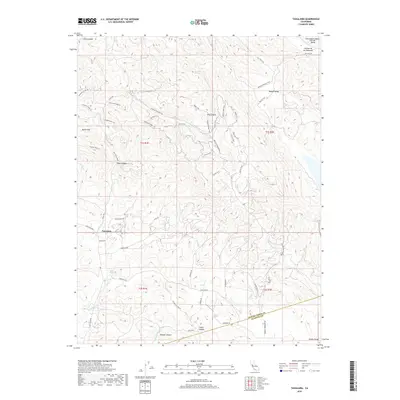
2018 Map of Tassajara
USGS Topo · Published 2018About this map
Tassajara serves as a central point in this part of the Diablo Range, where the boundary between Contra Costa and Alameda counties meets. The landscape is defined by a dense network of ridges and canyons, including Riggs Canyon and Collier Canyon, which are crisscrossed by a complex system of fire roads and recreational paths such as the Highland Ridge Trail and Volvon Loop Trail. A notable concentration of water features like Sycamore Spring and Cottonwood Creek drain the slopes of the Black Hills. This region maintains a distinctly rural and conservation-oriented character, with large expanses like Round Valley and the Cañada De Los Poblanos preserved as open space. Local history is etched into the topography through names like Old School Road, signaling the infrastructure of early ranching communities.
Find a feature on this map
56 named features on this map. Tap any name to fly to it.
Don’t see what you’re looking for? This feature index may not catch every label — zoom into the map to look around manually.
Map Details
Editions of this 2018 Tassajara Map
This is the sole edition of this map. No revisions or reprints were ever made.
Other maps of this area

1896 · Mt. Diablo
USGS Topo · 1:62,500

1898 · Mt. Diablo
USGS Topo · 1:62,500

1906 · Pleasanton
USGS Topo · 1:62,500

1907 · Tesla
USGS Topo · 1:62,500

1911 · Byron Hot Springs
USGS Topo · 1:31,680

1914 · Brentwood
USGS Topo · 1:31,680

1916 · Lone Tree Valley
USGS Topo · 1:31,680

1916 · Byron Hot Springs
USGS Topo · 1:31,680

1916 · Byron
USGS Topo · 1:62,500

1940 · Byron
USGS Topo · 1:62,500