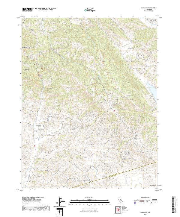
2021 Map of Tassajara
USGS Topo · Published 2021About this map
The Diablo Range dominates this landscape on the edge of the San Joaquin Valley, where the ridges of the Black Hills and steep drainages like Riggs Canyon transition into the eastern foothills. The small settlement of Tassajara sits at the junction of Finley Rd and Johnston Rd, serving as a focal point for a region defined by its canyons and historical ranch roads. This 2021 survey reveals a complex network of trails, including the Volvon Loop Trl and Eagle Trl, that traverse the high ground near Windy Point and Oyster Point.
Find a feature on this map
52 named features on this map. Tap any name to fly to it.
Don’t see what you’re looking for? This feature index may not catch every label — zoom into the map to look around manually.
Map Details
Editions of this 2021 Tassajara Map
This is the sole edition of this map. No revisions or reprints were ever made.
Other maps of this area

1896 · Mt. Diablo
USGS Topo · 1:62,500

1898 · Mt. Diablo
USGS Topo · 1:62,500

1906 · Pleasanton
USGS Topo · 1:62,500

1907 · Tesla
USGS Topo · 1:62,500

1911 · Byron Hot Springs
USGS Topo · 1:31,680

1914 · Brentwood
USGS Topo · 1:31,680

1916 · Lone Tree Valley
USGS Topo · 1:31,680

1916 · Byron Hot Springs
USGS Topo · 1:31,680

1916 · Byron
USGS Topo · 1:62,500

1940 · Byron
USGS Topo · 1:62,500