
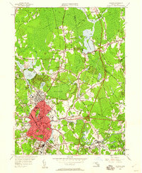
1949 Map of Taunton
USGS Topo · Published 1958About this map
Taunton serves as a dense industrial and institutional hub in this mid-century survey, defined by its intricate network of neighborhood schools and cemeteries. The city’s urban core is characterized by several major complexes, including the Taunton Insane Hospital and the Court House, while the outlying areas like Whittenton Junction and Weir Village show the tight integration of residential life with the New York New Haven and Hartford railroad.
Find a feature on this map
102 named features on this map. Tap any name to fly to it.
Don’t see what you’re looking for? This feature index may not catch every label — zoom into the map to look around manually.
Map Details
Editions of this 1949 Taunton Map
2 editions found
Other maps of this area

1885 · Abington
USGS Topo · 1:62,500

1885 · Middleboro
USGS Topo · 1:62,500

1885 · Taunton
USGS Topo · 1:62,500

1886 · Dedham
USGS Topo · 1:62,500

1888 · Taunton
USGS Topo · 1:62,500

1888 · Middleboro
USGS Topo · 1:62,500

1888 · Abington
USGS Topo · 1:62,500

1893 · Abington
USGS Topo · 1:62,500

1893 · Taunton
USGS Topo · 1:62,500

1893 · Middleboro
USGS Topo · 1:62,500