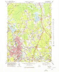
1978 Map of Taunton
USGS Topo · Published 1979About this map
Taunton and its surrounding Bristol County industrial and residential areas are shown here during a period of transition in the late 1970s. The urban core is dense with civic and religious landmarks, including the Courthouse, City Hall, and several prominent parishes like St Marys Ch and St Josephs Ch. To the north and east, the sprawling facilities of the Taunton State Hospital and its Borden Colony represent a significant land use, while the Dever State School occupies a large tract near Watson Pond. The landscape is defined by the massive Hockomock Swamp and Titicut Swamp, which constrain development and provide a natural buffer between the settlements of Raynham and West Bridgewater. Transport networks are evolving, with the Conrail lines still servicing industrial pockets like Whittenton Junction and Weir Village, while the newer highway system carves through the ancient wetlands.
Find a feature on this map
122 named features on this map. Tap any name to fly to it.
Don’t see what you’re looking for? This feature index may not catch every label — zoom into the map to look around manually.
Map Details
Editions of this 1978 Taunton Map
This is the sole edition of this map. No revisions or reprints were ever made.
Other maps of this area

1885 · Abington
USGS Topo · 1:62,500

1885 · Middleboro
USGS Topo · 1:62,500

1885 · Taunton
USGS Topo · 1:62,500

1886 · Dedham
USGS Topo · 1:62,500

1888 · Taunton
USGS Topo · 1:62,500

1888 · Middleboro
USGS Topo · 1:62,500

1888 · Abington
USGS Topo · 1:62,500

1893 · Abington
USGS Topo · 1:62,500

1893 · Taunton
USGS Topo · 1:62,500

1893 · Middleboro
USGS Topo · 1:62,500