Old Maps of Scotland Estates, Bridgewater
Explore 24 old maps of Scotland Estates, spanning from 1885 to today. These high-resolution historic maps reveal how streets, neighborhoods, landmarks, and natural features evolved over time — perfect for genealogy, metal detecting, research, and local history exploration.
What you can do with these maps:
- See how Scotland Estates changed over time: Compare historical maps to modern-day views to trace roads, homesites, rail lines & more.
- View detailed metadata: Each map includes creators, publishers, year, scale, and archive source.
- Overlay maps with satellite & LiDAR: Visualize the past alongside modern tools to explore terrain & human change.
- Trusted historical sources: Maps sourced from the USGS, Library of Congress, and other archives.
- Access maps your way: View online, download high-res files, or order prints for personal or research use.
Start exploring old maps of Scotland Estates to uncover forgotten places, hidden landmarks, and the deep history beneath your feet.
Scotland Estates, Bridgewater maps
(24)- 1885 Map of Taunton
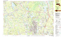
 1885 Taunton1885 Print · USGSTaunton and the surrounding Bristol County townships are shown here during a period of significant industrial and rail expansion. Researchers can trace historic family landmarks and local institutions like the State Hospital for the Insane, Dighton Rock, and the Swansea Factory.
 - 1888 Map of Taunton
 1888 Taunton1888 Print · USGSIn the late nineteenth century, this region of Bristol County was a bustling industrial and rail center. Researchers can trace the extensive Old Colony Railroad network through specialized stops like Britanniaville Station and Cranes Station.
 - 1893 Map of Taunton
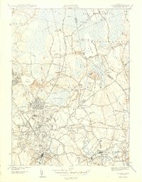
 1893 Taunton1893 Print · USGSTaunton flourished as a rail and manufacturing powerhouse during the late nineteenth century, situated at the nexus of the Old Colony Railroad system. Genealogists and historians can trace the early industrial sites like the Copper Works and Swansea Factory or find local landmarks such as Dighton Rock and the town Almshouse.7 unique versions available
 - 1918 Map of Taunton, 1921 Print
 1918 Taunton1921 Print · USGSSoutheastern Massachusetts at the close of the Great War is a dense network of industrial rail lines and riverside villages. You can trace the path of the Old Colony Railroad Main Line or locate local landmarks like the Copper Works and Annawon Rock.
 - 1943 Map of Providence
 1943 Providence1943 Print · USGSNarragansett Bay and the industrial Blackstone Valley appear here in the midst of the Second World War. Genealogists and researchers can trace local landmarks like Lonsdale Station, the St Marys Reservoir, and the Rhode Island State Airport.
 - 1944 Map of Taunton
 1944 Taunton1944 Print · USGSTaunton and Raynham are shown in the early 1940s, a landscape defined by the New York New Haven and Hartford railroad and the massive Hockomock Swamp. Trace local history at Camp Miles Standish, the Raynham Dog Track, and St Josephs Cem.4 unique versions available
 - 1947 Map of Providence, 1948 Print
 1947 Providence1948 Print · USGSSouthern New England is captured in the mid-1940s, showing a landscape defined by busy industrial ports and expanding military installations. Researchers can trace the rail lines of the N.Y. N.H. & H. RR or locate coastal defenses like Fort Adams and Quonset Point.5 unique versions available
 - 1948 Map of Providence, 1951 Print
 1948 Providence1951 Print · USGSSouthern New England’s coastal reaches are captured here in the late 1940s, from the industrial heart of Providence to the tip of Provincetown. Genealogists and historians can trace rail lines like the Central Vermont Railway and locate active military sites such as Otis Air Force Base and Fort Rodman.
 - 1949 Map of Taunton, 1958 Print
 1949 Taunton1958 Print · USGSTaunton and its surrounding villages are captured here in the years following the war, showing a landscape of rail-connected industry and established neighborhoods. Genealogists can locate family landmarks like Mayflower Hill Cem, the Leonard Sch, and the riverside Weir Village.2 unique versions available
 - 1957 Map of Providence
 1957 Providence1957 Print · USGSCoastal New England at the height of the mid-century era shows a landscape shaped by maritime industry and Cold War defense. Genealogists and historians can trace the reach of the New York, New Haven & Hartford RR and locate legacy sites like Fort Adams and Quonset Point Naval Air Station.
 - 1958 Map of Providence
 1958 Providence1958 Print · USGSThe Rhode Island and Massachusetts coastlines are shown in detail during the late 1950s, from the urban cores to the tips of the islands. Researchers can trace the mid-century footprint of Quonset Point Naval Air Station, the defense works at Fort Adams, and the rail network of the New York, New Haven and Hartford RR.
 - 1962 Map of Taunton, 1964 Print
 1962 Taunton1964 Print · USGSThe industrial and riverfront character of Taunton and Raynham is caught here in the early sixties, showing the city's growth alongside vast wetlands and bogs. Trace family roots and local history at institutional landmarks like the Taunton State Hospital and Mayflower Hill Cemetery.
 - 1963 Map of Providence
 1963 Providence1963 Print · USGSSouthern New England's coastal and industrial heartland is captured here in the early sixties, from the Rhode Island mainland to the far reaches of the Cape. Researchers can trace mid-century growth in Providence or locate landmarks on Marthas Vineyard and Nantucket Island.
 - 1977 Map of Taunton, 1981 Print
 1977 Taunton1981 Print · USGSThe Bristol County landscape in the late seventies is shown in photographic detail, capturing the dense street patterns and suburban growth around the Taunton River. Researchers can trace the layout of Taunton and Raynham Center or locate properties near the shores of Lake Nippenicket.
 - 1978 Map of Taunton, 1979 Print
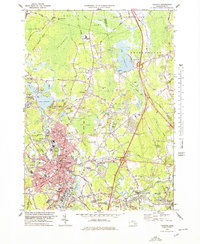 1978 Taunton1979 Print · USGSTaunton and Raynham are caught in a moment of late twentieth-century growth, balanced against the expansive Hockomock and Titicut Swamps. Genealogists and local historians can trace family locations near Mayflower Hill Cemetery, explore the industrial rail legacy of Whittenton Junction, or locate the many neighborhood schools like Leonard Sch and Mulcahey Sch.
 - 1979 Map of Taunton
 1979 Taunton1979 Print · USGSSoutheastern Massachusetts in the late seventies reveals a landscape of industrial river towns and sprawling state institutions. Local historians can trace the development of Taunton and its neighboring villages, locating sites like Wheaton College, Raynham Racetrack, and the Mayflower Hill Cem.
 - 1984 Map of Providence, 1985 Print
 1984 Providence1985 Print · USGSThe Rhode Island coast and its industrial heartlands are captured here in the mid-eighties, showing the density of the Providence metro area. Researchers can trace historic rail lines like the Providence & Worcester RR and explore the maritime layout of Narragansett Bay and Newport.
 - 1987 Map of Taunton
 1987 Taunton1987 Print · USGSSoutheastern Massachusetts in the late eighties shows a landscape of growing suburbs, historic rail lines, and vast wetlands. Researchers can trace the development of Taunton and Norton alongside institutions like Wheaton College and landmarks such as Mayflower Hill Cemetery.2 unique versions available
 - 2012 Map of Taunton, 2012 Print
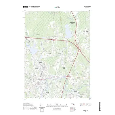
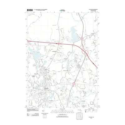 2012 Taunton2012 Print · USGSCovers Scotland Estates, including Taunton, Bridgewater, and other nearby areas
 - 2015 Map of Taunton, 2015 Print
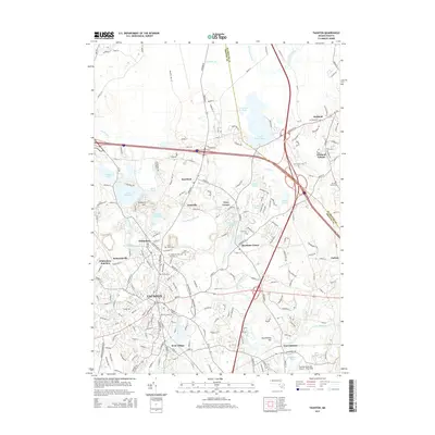 2015 Taunton2015 Print · USGSCovers Scotland Estates, including Taunton, Bridgewater, and other nearby areas
 - 2018 Map of Taunton, 2018 Print
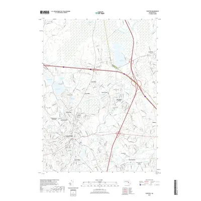 2018 Taunton2018 Print · USGSCovers Scotland Estates, including Taunton, Bridgewater, and other nearby areas
 - 2021 Map of Taunton, 2021 Print
 2021 Taunton2021 Print · USGSCovers Scotland Estates, including Taunton, Bridgewater, and other nearby areas
 - 2023 Map of Taunton, 2023 Print
 2023 Taunton2023 Print · USGSCovers Scotland Estates, including Taunton, Bridgewater, and other nearby areas
 - 2024 Map of Taunton, 2024 Print
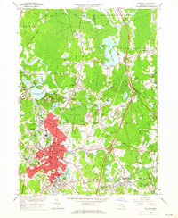
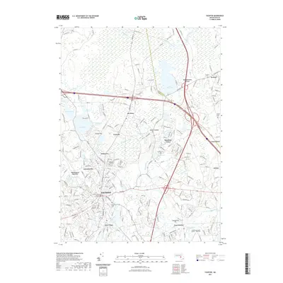
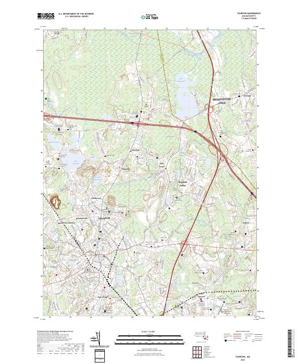 2024 Taunton2024 Print · USGSTaunton and Raynham are shown here during the early twenty-first century, showcasing a landscape where urban centers meet massive wetlands. Researchers can trace dozens of burial grounds like Colored Cem and Father Wilson Cem or locate the Bristol County Superior Court House.
End of results
Showing maps 1-24 of 24
Top cities near Scotland Estates
- Brockton historical maps
- New Bedford historical maps
- Fall River historical maps
- Taunton historical maps
- Weymouth historical maps
- Attleboro historical maps
See more
Frequently asked questions
- What are the different types of historical maps available for Scotland Estates?
- What is the oldest map of Scotland Estates?
- Where can I purchase historical maps of Scotland Estates for my home or office?
- Where can I download high-res historical maps of Scotland Estates?
- Are there historical topographic maps available for Scotland Estates?
- Is there historical aerial imagery available for Scotland Estates?
- Where are historical maps of Scotland Estates sourced from?