
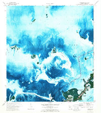
1971 Map of Tavernier
USGS Topo · Published 1973About this map
The waters of Florida Bay dominate this 1971 orthophotomap, showing the delicate marine geography where the Everglades National Park boundary meets the Florida Keys. The settlement of Tavernier serves as the focal point on Plantation Key, centered near Community Harbor and Tavernier Harbor. The map reveals the intricate network of shoals and channels vital to the region's maritime character, including the Intracoastal Waterway and navigation hazards like Ramshorn Shoal. Local landmarks such as the Burton Memorial United Ch and the Pt Lowe promontory provide fixed points on the shoreline. Farther out, numerous keys like Butternut Key, Pigeon Key, and the Bob Keys dot the shallows, while features like Upper Cross Bank and Cross Bank delineate the submerged topography of the bay.
Find a feature on this map
29 named features on this map. Tap any name to fly to it.
Don’t see what you’re looking for? This feature index may not catch every label — zoom into the map to look around manually.
Map Details
Editions of this 1971 Tavernier Map
2 editions found
Other maps of this area

1947 · Rock Harbor
USGS Topo · 1:24,000

1947 · Blackwater Sound
USGS Topo · 1:24,000

1949 · Blackwater Sound
USGS Topo · 1:24,000

1949 · Rock Harbor
USGS Topo · 1:24,000

1956 · Miami
USGS Topo · 1:250,000

1958 · Miami
USGS Topo · 1:250,000

1971 · Upper Matecumbe Key
USGS Topo · 1:24,000

1971 · Plantation Key
USGS Topo · 1:24,000

1972 · Madeira Bay
USGS Topo · 1:24,000

1972 · Calusa Keys
USGS Topo · 1:24,000