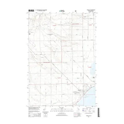
2014 Map of Tawas City
USGS Topo · Published 2014About this map
Tawas City and East Tawas anchor the shoreline where the Tawas River meets the protected waters of Tawas Bay in this coastal Michigan study. The landscape is defined by the transition from the dense timberlands of the Huron National Forest to the developed harbor fronts. Several local burial sites, including Wilber Cem, Laidlaw Cem, and Zion Cem, are situated inland, while the Immaculate Heart of Mary's Catholic Cem and Emmanuel Lutheran Cem are located near the city center.
Find a feature on this map
47 named features on this map. Tap any name to fly to it.
Don’t see what you’re looking for? This feature index may not catch every label — zoom into the map to look around manually.
Map Details
Editions of this 2014 Tawas City Map
This is the sole edition of this map. No revisions or reprints were ever made.
Other maps of this area

1954 · Tawas City
USGS Topo · 1:250,000

1958 · Tawas City
USGS Topo · 1:250,000

1959 · Tawas City
USGS Topo · 1:62,500

1959 · East Tawas
USGS Topo · 1:62,500

1966 · Alabaster
USGS Topo · 1:24,000

1966 · National City
USGS Topo · 1:24,000

1984 · Tawas City
USGS Topo · 1:100,000
1989 · Foote Site Village
USGS Topo · 1:24,000
1989 · East Tawas
USGS Topo · 1:24,000
1989 · Sid Town
USGS Topo · 1:24,000