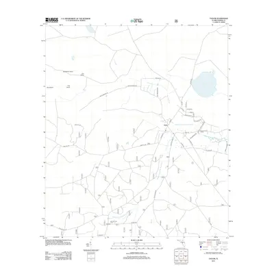
2012 Map of Taylor
USGS Topo · Published 2012About this map
The Middle Prong Saint Marys River meanders through this portion of Baker County, anchoring the small community of Taylor. The landscape is defined by the hydrologic transition between the river and the vast swampy flats, evidenced by numerous named islands like Huckleberry Island, Lice Island, and Dog Island that rise just above the wetlands. These features, along with Little River Bay and Ellis Bay, illustrate the complex drainage patterns of the Florida-Georgia borderlands.
Find a feature on this map
50 named features on this map. Tap any name to fly to it.
Don’t see what you’re looking for? This feature index may not catch every label — zoom into the map to look around manually.
Map Details
Editions of this 2012 Taylor Map
This is the sole edition of this map. No revisions or reprints were ever made.
Other maps of this area

1917 · Macclenny
USGS Topo · 1:62,500

1918 · Moniac
USGS Topo · 1:62,500

1918 · Macclenny
USGS Topo · 1:62,500

1942 · Moniac
USGS Topo · 1:62,500

1954 · Valdosta
USGS Topo · 1:250,000

1956 · Eddy
USGS Topo · 1:24,000

1956 · Sargent
USGS Topo · 1:24,000

1958 · Valdosta
USGS Topo · 1:250,000

1959 · Valdosta
USGS Topo · 1:250,000
1967 · Moniac
USGS Topo · 1:24,000