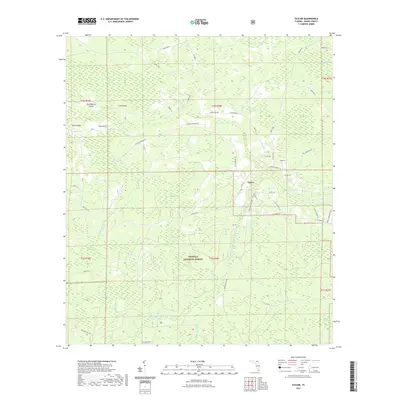
2021 Map of Taylor
USGS Topo · Published 2021About this map
The community of Taylor serves as the primary settlement hub in this part of Baker County, situated where Co Rd 250 and Co Rd 125 intersect. This landscape is defined by the complex hydrology of the northern Osceola National Forest, where numerous named bays and swamps create a mosaic of wet pine flatwoods and cypress strands. Key watercourses like the Middle Prong Saint Marys River and the Little River drain through a series of islands, including Huckleberry Island and Lice Island, which represent slightly higher ground amidst the surrounding Pinhook Swamp and Moccasin Swamp.
Find a feature on this map
67 named features on this map. Tap any name to fly to it.
Don’t see what you’re looking for? This feature index may not catch every label — zoom into the map to look around manually.
Map Details
Editions of this 2021 Taylor Map
This is the sole edition of this map. No revisions or reprints were ever made.
Other maps of this area

1917 · Macclenny
USGS Topo · 1:62,500

1918 · Moniac
USGS Topo · 1:62,500

1918 · Macclenny
USGS Topo · 1:62,500

1942 · Moniac
USGS Topo · 1:62,500

1954 · Valdosta
USGS Topo · 1:250,000

1956 · Eddy
USGS Topo · 1:24,000

1956 · Sargent
USGS Topo · 1:24,000

1958 · Valdosta
USGS Topo · 1:250,000

1959 · Valdosta
USGS Topo · 1:250,000
1967 · Moniac
USGS Topo · 1:24,000