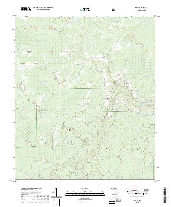
2024 Map of Taylor
USGS Topo · Published 2024About this map
The unincorporated community of Taylor serves as the central hub of this Baker County landscape, situated just north of the Osceola National Forest. The geography is defined by a complex network of wetlands and bays, including Surveyors Bay, Cattail Bay, and Betts Eddy Bay, which drain through the Middle-Prong Saint Marys River. This riverine system and the surrounding forest are accessed by a grid of specialized forestry and local roads named for prominent area families, such as Lilla Harvey Rd, Thannie Harvey Rd, and Morris Dowling Rd. The presence of Camp Osceola Rd near the forest boundary suggests a landscape managed for both timber and recreation. These family-named roads and remote bay features provide a window into the rural settlement patterns and timber-dependent economy of northern Florida's swamp country.
Find a feature on this map
65 named features on this map. Tap any name to fly to it.
Don’t see what you’re looking for? This feature index may not catch every label — zoom into the map to look around manually.
Map Details
Editions of this 2024 Taylor Map
This is the sole edition of this map. No revisions or reprints were ever made.
Other maps of this area

1917 · Macclenny
USGS Topo · 1:62,500

1918 · Moniac
USGS Topo · 1:62,500

1918 · Macclenny
USGS Topo · 1:62,500

1942 · Moniac
USGS Topo · 1:62,500

1954 · Valdosta
USGS Topo · 1:250,000

1956 · Eddy
USGS Topo · 1:24,000

1956 · Sargent
USGS Topo · 1:24,000

1958 · Valdosta
USGS Topo · 1:250,000

1959 · Valdosta
USGS Topo · 1:250,000
1967 · Moniac
USGS Topo · 1:24,000