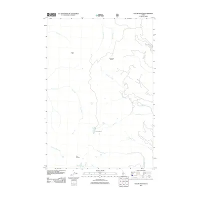
2011 Map of Taylor Mountain
USGS Topo · Published 2011About this map
Taylor Mountain and Moyer Peak anchor this high-elevation landscape in Custer County, Idaho, where the terrain is defined by a dense network of alpine drainage systems. The map depicts a wilderness environment largely shaped by water, from the headwaters of Salt Creek and Woodtick Creek in the north to the South Fork Moyer Creek in the south. The presence of Iron Lake Campground near the center of the sheet indicates the area's role as a destination for backcountry recreation, situated strategically near Iron Lake and the confluence of several branches of Iron Creek. Local history and geography enthusiasts can trace the intricate paths of West Fork Iron Creek and South Fork Iron Creek as they navigate the steep slopes. High-altitude features like Squawboard Meadow and Hat Creek Lakes provide specific landmarks for those studying the natural character of this portion of the Salmon River Mountains during the early 21st century.
Find a feature on this map
16 named features on this map. Tap any name to fly to it.
Don’t see what you’re looking for? This feature index may not catch every label — zoom into the map to look around manually.
Map Details
Editions of this 2011 Taylor Mountain Map
This is the sole edition of this map. No revisions or reprints were ever made.
Other maps of this area

1950 · Blackbird Mtn
USGS Topo · 1:62,500

1950 · Leesburg
USGS Topo · 1:62,500

1951 · Leesburg
USGS Topo · 1:62,500

1951 · Blackbird Mtn
USGS Topo · 1:62,500

1956 · Elk City
USGS Topo · 1:250,000

1957 · Challis
USGS Topo · 1:250,000

1960 · Elk City
USGS Topo · 1:250,000

1960 · Challis
USGS Topo · 1:250,000
1962 · Degan Mtn
USGS Topo · 1:24,000

1963 · Challis
USGS Topo · 1:250,000