
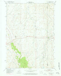
1954 Map of Taylor Ranch
USGS Topo · Published 1956About this map
The Bozeman Trail cuts across this high plains landscape of the mid-1950s, following the divide between the Dry Fork Powder River and the main channel of the Powder River. This area on the Johnson and Campbell county line is defined by its ranching heritage and water management, featuring a landscape dotted with an Artesian Well and family-run operations such as the U T Ranch and Taylor Ranch.
Find a feature on this map
25 named features on this map. Tap any name to fly to it.
Don’t see what you’re looking for? This feature index may not catch every label — zoom into the map to look around manually.
Map Details
Editions of this 1954 Taylor Ranch Map
2 editions found
Other maps of this area

1953 · Dry Fork Ranch
USGS Topo · 1:24,000

1953 · Rolling Pin Ranch
USGS Topo · 1:24,000

1954 · House Creek
USGS Topo · 1:24,000

1954 · Artesian Draw
USGS Topo · 1:24,000

1954 · Linch
USGS Topo · 1:24,000

1955 · Newcastle
USGS Topo · 1:250,000

1955 · Arminto
USGS Topo · 1:250,000

1958 · Arminto
USGS Topo · 1:250,000

1958 · Newcastle
USGS Topo · 1:250,000

1959 · Edgerton
USGS Topo · 1:62,500