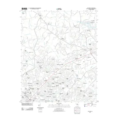
2011 Map of Taylors
USGS Topo · Published 2011About this map
The Enoree River and South Tyger River systems anchor this detailed landscape in northeastern Greenville County, illustrating a densely developed suburban corridor between major South Carolina hubs. Significant residential growth is evident through named subdivisions like Colony Subdivision, Wade Hampton, and Edwards Forest Heights, which surround the central community of Taylors. The map documents a rich spiritual and educational history, featuring several long-standing burial grounds such as Double Springs Cemetery and Milford Cemetery, alongside the sprawling campus of Bob Jones University. Natural landmarks like the eastern slopes of Paris Mountain State Park and Lake Placid provide a contrast to the industrial and commercial activity centered near the Taylors Post Office. This survey records a complex network of creeks, including Beaverdam Creek and Mountain Creek, that shaped the early settlement patterns of old communities like Sandy Flat and Chick Springs.
Find a feature on this map
298 named features on this map. Tap any name to fly to it.
Don’t see what you’re looking for? This feature index may not catch every label — zoom into the map to look around manually.
Map Details
Editions of this 2011 Taylors Map
This is the sole edition of this map. No revisions or reprints were ever made.
Other maps of this area

1907 · Saluda
USGS Topo · 1:125,000

1935 · Greer
USGS Topo · 1:48,000

1935 · Greenville
USGS Topo · 1:48,000

1938 · Greenville
USGS Topo · 1:62,500

1938 · Greer
USGS Topo · 1:62,500

1954 · Greenville
USGS Topo · 1:250,000

1955 · Knoxville
USGS Topo · 1:250,000

1957 · Greenville
USGS Topo · 1:24,000

1957 · Greer
USGS Topo · 1:62,500

1957 · Greenville
USGS Topo · 1:62,500