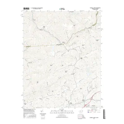
2016 Map of Tazewell North
USGS Topo · Published 2016About this map
The West Virginia-Virginia state line bisects this 2016 survey, cutting through the Appalachian coalfields and the valley of Jacobs Fork. The landscape is defined by its deep hollows and high ridges, including Stony Ridge and Big Stone Ridge, which separate various small mining and residential communities. In the northern section, West Virginia settlements like Squire and Jacobs Fork sit along the creek, while the Virginia side features the town of Bishop straddling the border. To the south, the terrain opens into Baptist Valley and the more developed corridors of North Tazewell and the northern edge of Tazewell. Transportation in this era is centered on routes like the Trail of the Lonesome Pine, which follows the rail line through the Clinch River valley, passing near Maplewood Cemetery. The map captures the complex geography of the Tennessee Valley Divide and the network of local roads such as Baptist Valley Road that connect these mountain gaps.
Find a feature on this map
110 named features on this map. Tap any name to fly to it.
Don’t see what you’re looking for? This feature index may not catch every label — zoom into the map to look around manually.
Map Details
Editions of this 2016 Tazewell North Map
This is the sole edition of this map. No revisions or reprints were ever made.
Other maps of this area

1887 · Pocahontas
USGS Topo · 1:125,000

1891 · Tazewell
USGS Topo · 1:125,000

1891 · Pocahontas
USGS Topo · 1:125,000

1894 · Pocahontas
USGS Topo · 1:125,000

1895 · Tazewell
USGS Topo · 1:125,000

1895 · Pocahontas
USGS Topo · 1:125,000

1897 · Tazewell
USGS Topo · 1:125,000

1909 · Pocahontas Special
USGS Topo · 1:48,000

1911 · Pocahontas Special
USGS Topo · 1:62,500

1912 · Pounding Mill
USGS Topo · 1:62,500