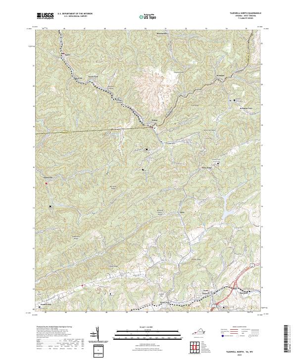
2023 Map of Tazewell North
USGS Topo · Published 2023About this map
Tazewell and North Tazewell anchor the southern edge of this landscape, situated along the Clinch River at the foot of Whitley Ridge. The topography is defined by the Tennessee Valley Divide, a natural barrier separating the waters of the Clinch from the northward-flowing drainage systems. To the north, the terrain is marked by industrial footprints such as the Bishop Prep Plant Slurry Impoundment, reflecting the region's coal processing legacy near the West Virginia border.
Find a feature on this map
108 named features on this map. Tap any name to fly to it.
Don’t see what you’re looking for? This feature index may not catch every label — zoom into the map to look around manually.
Map Details
Editions of this 2023 Tazewell North Map
This is the sole edition of this map. No revisions or reprints were ever made.
Other maps of this area

1887 · Pocahontas
USGS Topo · 1:125,000

1891 · Tazewell
USGS Topo · 1:125,000

1891 · Pocahontas
USGS Topo · 1:125,000

1894 · Pocahontas
USGS Topo · 1:125,000

1895 · Tazewell
USGS Topo · 1:125,000

1895 · Pocahontas
USGS Topo · 1:125,000

1897 · Tazewell
USGS Topo · 1:125,000

1909 · Pocahontas Special
USGS Topo · 1:48,000

1911 · Pocahontas Special
USGS Topo · 1:62,500

1912 · Pounding Mill
USGS Topo · 1:62,500