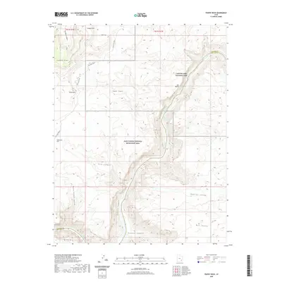
2020 Map of Teapot Rock
USGS Topo · Published 2020About this map
Cataract Canyon and the winding course of the Colorado River define this high-desert region where the boundaries of Canyonlands National Park and Glen Canyon National Recreation Area meet. The river landscape is characterized by its powerful water features, including the Mile Long Rapids and Big Drop Rapids, which have long challenged navigation through this section of the canyon system. On the western plateau, the Orange Cliffs rise above the Doll House Road, a remote track that provides access to topographic landmarks such as Teapot Rock and The Button. The map also illustrates the transition from high points like Lands End down to the interior reaches of Calf Canyon and Easter Pasture Canyon, revealing a drainage network that eventually converges at Gypsum Canyon. This survey captures the complex intersection of Garfield and San Juan counties within one of the most remote canyon systems in the American West.
Find a feature on this map
23 named features on this map. Tap any name to fly to it.
Don’t see what you’re looking for? This feature index may not catch every label — zoom into the map to look around manually.
Map Details
Editions of this 2020 Teapot Rock Map
This is the sole edition of this map. No revisions or reprints were ever made.
Other maps of this area

1885 · San Rafael
USGS Topo · 1:250,000
1885 · La Sal
USGS Topo · 1:250,000

1886 · Henry Mountains
USGS Topo · 1:250,000
1886 · Abajo
USGS Topo · 1:250,000
1892 · Abajo
USGS Topo · 1:250,000

1892 · Henry Mountains
USGS Topo · 1:250,000
1893 · Abajo
USGS Topo · 1:250,000
1935 · Elk Ridge
USGS Topo · 1:96,000
1940 · Elk Ridge
USGS Topo · 1:125,000
1952 · Mouth of Dark Canyon
USGS Topo · 1:62,500