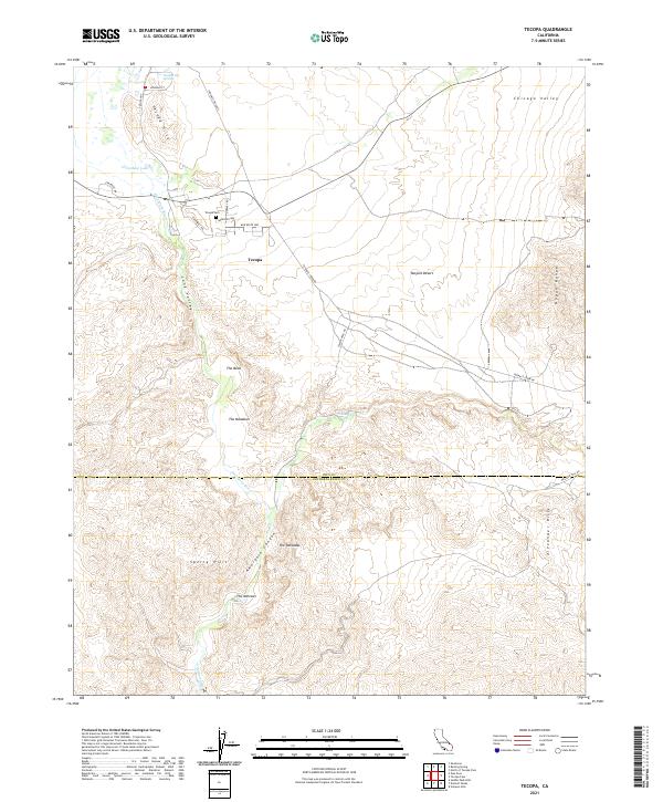
2021 Map of Tecopa
USGS Topo · Published 2021About this map
The Amargosa River carves through this arid landscape, anchoring the settlement of Tecopa and its surrounding desert basins. This 2021 survey illustrates a region defined by groundwater and thermal activity, where Tecopa Hot Springs and Grimshaw Lake provide vital water sources in the Mojave Desert. The topography reveals a complex network of geological formations, from the steep Nopah Range in the northeast to the dramatic relief of Amargosa Canyon and The Palisades in the south. For local historians and genealogists, the map identifies the Tecopa Cem and established routes like Furnace Creek Rd and China Ranch Rd. These tracks connect the valley floor to landmarks such as The Bowl and The Meadows, showing how local infrastructure navigates the Sperry Hills and Alexander Hills along the boundary of Inyo and San Bernardino counties.
Find a feature on this map
37 named features on this map. Tap any name to fly to it.
Don’t see what you’re looking for? This feature index may not catch every label — zoom into the map to look around manually.
Map Details
Editions of this 2021 Tecopa Map
This is the sole edition of this map. No revisions or reprints were ever made.
Other maps of this area

1933 · Avawatz Mountains
USGS Topo · 1:250,000

1947 · Trona
USGS Topo · 1:250,000

1948 · Trona
USGS Topo · 1:250,000

1948 · Avawatz Pass
USGS Topo · 1:62,500

1950 · Tecopa
USGS Topo · 1:62,500

1951 · Avawatz Pass
USGS Topo · 1:62,500

1951 · Tecopa
USGS Topo · 1:62,500

1951 · Shoshone
USGS Topo · 1:62,500

1953 · Trona
USGS Topo · 1:250,000

1956 · Silurian Hills
USGS Topo · 1:62,500