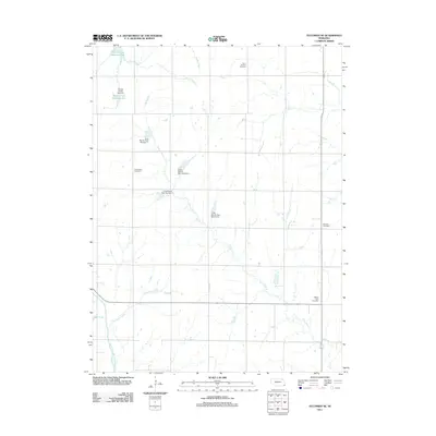
2011 Map of Tecumseh SE
USGS Topo · Published 2011About this map
The North Fork Big Nemaha River winds through the southwestern corner of this landscape, anchoring a complex drainage system in Johnson County defined by agricultural engineering. This era of water management is visible through numerous impoundments, including Spring Creek Reservoir 9-3 and a series of numbered structures such as Long Branch Dam Number 2 and Long Branch Dam Number 3. These dams across the Long Branch and Spring Creek tributaries illustrate the systematic efforts to control local hydrology for soil conservation and flood mitigation in the Nebraska plains.
Find a feature on this map
19 named features on this map. Tap any name to fly to it.
Don’t see what you’re looking for? This feature index may not catch every label — zoom into the map to look around manually.
Map Details
Editions of this 2011 Tecumseh SE Map
This is the sole edition of this map. No revisions or reprints were ever made.
Other maps of this area

1915 · Howe
USGS Topo · 1:62,500

1916 · Humboldt
USGS Topo · 1:62,500

1955 · Nebraska City
USGS Topo · 1:250,000

1955 · Lincoln
USGS Topo · 1:250,000

1957 · Nebraska City
USGS Topo · 1:250,000

1957 · Lincoln
USGS Topo · 1:250,000

1958 · Lincoln
USGS Topo · 1:250,000

1958 · Nebraska City
USGS Topo · 1:250,000

1965 · Table Rock
USGS Topo · 1:24,000

1965 · Tecumseh
USGS Topo · 1:24,000