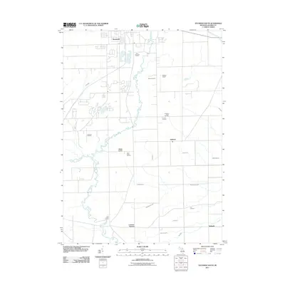
2011 Map of Tecumseh South
USGS Topo · Published 2011About this map
The River Raisin carves a winding path south from Tecumseh, anchoring a rural Lenawee County landscape defined by agricultural drainage and small rail-side hamlets. In the early 21st century, the area retains its traditional character at Raisin Center and Lenawee Junction, where the intersection of transit lines once shaped local commerce. The map is particularly notable for its density of burial grounds, ranging from established sites like McLain Cemetery to smaller family plots such as the Clark Family Cemetery and Holdridge Family Cemetery, providing valuable data for genealogical research. Numerous named watercourses, including Swamp Raisin Creek, Cook Drain, and the Little River Raisin, illustrate the complex drainage system necessary for the region's productive farmland. Modern land use is evident at the Raisin Valley Golf Course and Merillat Airport, while the village of Holloway remains a key waypoint in the eastern portion of the quadrangle.
Find a feature on this map
27 named features on this map. Tap any name to fly to it.
Don’t see what you’re looking for? This feature index may not catch every label — zoom into the map to look around manually.
Map Details
Editions of this 2011 Tecumseh South Map
This is the sole edition of this map. No revisions or reprints were ever made.
Other maps of this area

1904 · Ann Arbor
USGS Topo · 1:125,000

1906 · Saline
USGS Topo · 1:62,500

1908 · Ann Arbor
USGS Topo · 1:125,000

1939 · Blissfield
USGS Topo · 1:62,500

1941 · Blissfield
USGS Topo · 1:62,500

1948 · Manchester
USGS Topo · 1:62,500

1949 · Manchester
USGS Topo · 1:62,500

1953 · Fort Wayne
USGS Topo · 1:250,000

1954 · Detroit
USGS Topo · 1:250,000

1956 · Fort Wayne
USGS Topo · 1:250,000