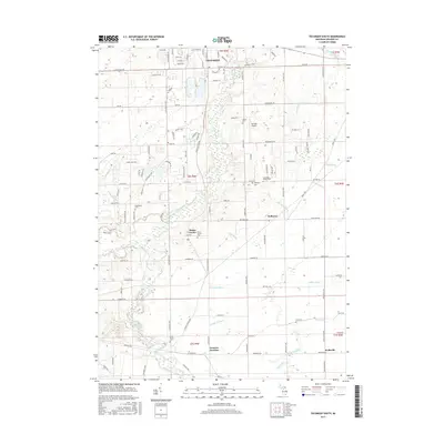
2017 Map of Tecumseh South
USGS Topo · Published 2017About this map
River Raisin meanders southward from the southern outskirts of Tecumseh, anchoring a landscape defined by its intricate drainage network and agricultural heritage. The southern reaches of the city give way to a structured grid of rural roads and small crossroads settlements, including Holloway and Wellsville. This 2017 survey reveals the density of family history in the region, marked by numerous small burial grounds such as Holdridge Family Cem and Clark Family Cem. The presence of Lenawee Junction highlights the historical importance of rail connectivity in Lenawee County, even as the landscape modernizes with features like the Merillat Airport. The map documents a complex system of named waterways, including Sutton Drain, Ash Drain, and Miller Drain, which manage the flow through the low-lying terrain surrounding Raisin Center.
Find a feature on this map
121 named features on this map. Tap any name to fly to it.
Don’t see what you’re looking for? This feature index may not catch every label — zoom into the map to look around manually.
Map Details
Editions of this 2017 Tecumseh South Map
This is the sole edition of this map. No revisions or reprints were ever made.
Other maps of this area

1904 · Ann Arbor
USGS Topo · 1:125,000

1906 · Saline
USGS Topo · 1:62,500

1908 · Ann Arbor
USGS Topo · 1:125,000

1939 · Blissfield
USGS Topo · 1:62,500

1941 · Blissfield
USGS Topo · 1:62,500

1948 · Manchester
USGS Topo · 1:62,500

1949 · Manchester
USGS Topo · 1:62,500

1953 · Fort Wayne
USGS Topo · 1:250,000

1954 · Detroit
USGS Topo · 1:250,000

1956 · Fort Wayne
USGS Topo · 1:250,000