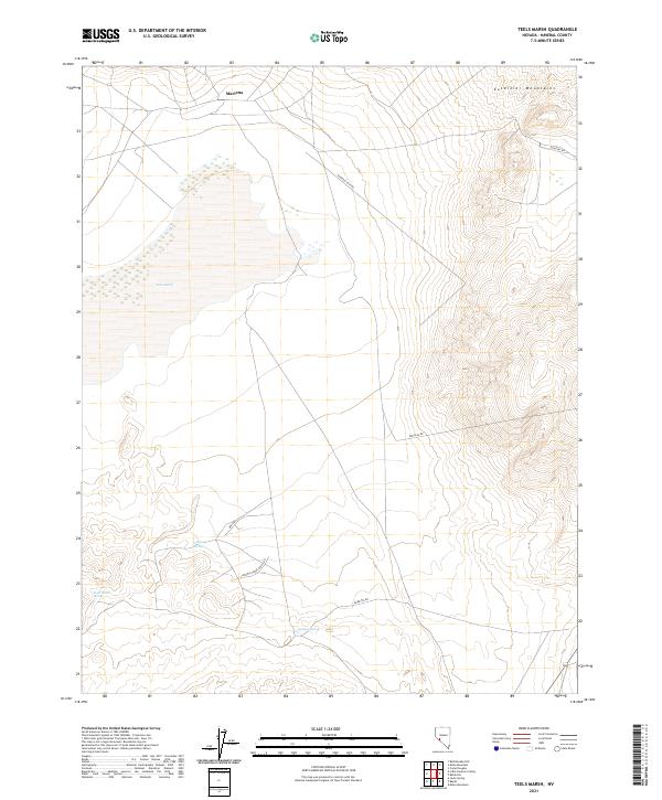
2021 Map of Teels Marsh
USGS Topo · Published 2021About this map
The high desert terrain of Mineral County is defined by the stark expanse of Teels Marsh, a salt pan that dominates the western half of this survey. To the north, the small settlement of Marietta sits at the base of the Excelsior Mountains, which rise sharply along the northern and eastern borders of the quadrangle. The landscape is marked by the critical importance of water in an arid environment, evidenced by named water sources such as German Spring, Company Spring, and Rock House Spring.
Find a feature on this map
19 named features on this map. Tap any name to fly to it.
Don’t see what you’re looking for? This feature index may not catch every label — zoom into the map to look around manually.
Map Details
Editions of this 2021 Teels Marsh Map
This is the sole edition of this map. No revisions or reprints were ever made.
Other maps of this area

1909 · Hawthorne
USGS Topo · 1:250,000

1911 · Hawthorne
USGS Topo · 1:250,000

1915 · Hawthorne
USGS Topo · 1:250,000

1948 · Walker Lake
USGS Topo · 1:250,000

1957 · Walker Lake
USGS Topo · 1:250,000

1962 · Walker Lake
USGS Topo · 1:250,000

1964 · Walker Lake
USGS Topo · 1:250,000
1967 · Miller Mountain
USGS Topo · 1:24,000

1967 · Moho Mountain
USGS Topo · 1:24,000
1967 · Basalt
USGS Topo · 1:24,000