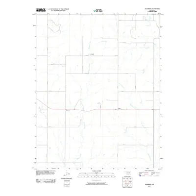
2010 Map of Tegarden
USGS Topo · Published 2010About this map
Whitehorse Creek and Eagle Chief Creek wind through this rural Woods County landscape, defining the topography of an area dominated by agricultural sections and section-line roads. The small settlements of Tegarden and Cora are positioned along the primary east-west highway, representing the quiet focal points of this prairie community. A significant site for local history and genealogy is the Whitehorse Cemetery, situated near the center of the quadrangle north of the Whitehorse Creek headwaters. The grid pattern of local roads, such as n2270 RD and e0130 RD, illustrates the systematic land division typical of the Oklahoma plains. Further north, Turkey Creek cuts across the northeastern corner, completing a drainage system that has influenced the placement of homesteads and farmstead infrastructure in this open terrain.
Find a feature on this map
24 named features on this map. Tap any name to fly to it.
Don’t see what you’re looking for? This feature index may not catch every label — zoom into the map to look around manually.
Map Details
Editions of this 2010 Tegarden Map
This is the sole edition of this map. No revisions or reprints were ever made.
Other maps of this area

1955 · Woodward
USGS Topo · 1:250,000

1958 · Woodward
USGS Topo · 1:250,000

1969 · Tegarden NE
USGS Topo · 1:24,000

1969 · Tegarden SE
USGS Topo · 1:24,000

1969 · Waynoka NW
USGS Topo · 1:24,000

1969 · Tegarden NW
USGS Topo · 1:24,000

1969 · Avard
USGS Topo · 1:24,000

1969 · Tegarden
USGS Topo · 1:24,000

1970 · Freedom NE
USGS Topo · 1:24,000

1970 · Fairvalley
USGS Topo · 1:24,000