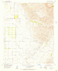
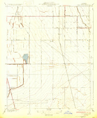
1955 Map of Tejon Hills
USGS Topo · Published 1956About this map
The Rancho El Tejon Boundary Grant carves through this landscape, marking the historic land division between the flat San Joaquin Valley floor and the rising Tehachapi Mts. In the mid-1950s, this area was a primary intersection of agricultural and petroleum production, evidenced by the Comanche Point Oil Field and the El Tejon Field. On the valley floor, infrastructure like the Cotton Gin near No Name Road supported the local farming economy, while the settlement of Caparell sat at the base of the Tejon Hills. Numerous watercourses, including Tejon Creek and Tunis Creek, emerge from the higher elevations, flowing toward the valley. The presence of Bino Springs and various oil tanks across the hillsides illustrates how early water sources and industrial energy developments dictated the placement of mountain-access roads and pipelines during this era of Kern County growth.
Find a feature on this map
20 named features on this map. Tap any name to fly to it.
Don’t see what you’re looking for? This feature index may not catch every label — zoom into the map to look around manually.
Map Details
Editions of this 1955 Tejon Hills Map
4 editions found
Other maps of this area

1903 · Tejon
USGS Topo · 1:125,000

1914 · Caliente
USGS Topo · 1:125,000

1930 · Weed Patch
USGS Topo · 1:31,680

1930 · Bear Mountain
USGS Topo · 1:31,680

1930 · Arvin
USGS Topo · 1:31,680

1931 · West of Tejon Hills
USGS Topo · 1:31,680

1931 · Tejon Hills
USGS Topo · 1:31,680

1933 · Arvin
USGS Topo · 1:31,680
1933 · Weed Patch
USGS Topo · 1:31,680

1933 · Tejon Hills
USGS Topo · 1:31,680