
1964 Map of Tekoa
USGS Topo · Published 1965About this map
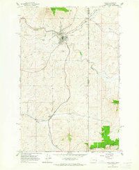
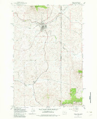
Tekoa serves as the primary hub of this 1960s landscape, positioned where the Chicago Milwaukee St Paul and Pacific and Union Pacific railroads intersect. The town's layout is meticulously detailed, showing residential blocks and specialized infrastructure like the Sewage Disposal plant. To the south, the rail lines diverge toward the smaller settlement of Seltice along Willow Creek. The terrain is defined by the significant rise of Tekoa Mountain to the north and Liberty Butte to the southeast.
Find a feature on this map
27 named features on this map. Tap any name to fly to it.
Don’t see what you’re looking for? This feature index may not catch every label — zoom into the map to look around manually.
Map Details
Editions of this 1964 Tekoa Map
Other maps of this area

1903 · Oakesdale
USGS Topo · 1:125,000

1905 · Oakesdale
USGS Topo · 1:125,000

1954 · Fairfield
USGS Topo · 1:62,500

1955 · Spokane
USGS Topo · 1:250,000

1957 · Plummer
USGS Topo · 1:62,500

1957 · Tensed
USGS Topo · 1:62,500

1958 · Spokane
USGS Topo · 1:250,000

1964 · Oakesdale
USGS Topo · 1:24,000
1964 · Garfield
USGS Topo · 1:24,000
1964 · Farmington
USGS Topo · 1:24,000