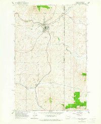
1964 Map of Tekoa
USGS Topo · Published 1965About this map
Tekoa sits at the junction of the Chicago Milwaukee St Paul and Pacific and the Union Pacific railroads, serving as a vital agricultural and transport hub on the border of Washington and Idaho in the mid-1960s. The landscape is defined by the winding course of Hangman Creek and its many tributaries, such as Little Hangman Creek and Cabbage Creek, which carve through the undulating Palouse terrain. To the north, the elevation rises toward Tekoa Mountain, while the southern reaches feature the forested slopes of Mary Minerva McCroskey State Park.
Find a feature on this map
24 named features on this map. Tap any name to fly to it.
Don’t see what you’re looking for? This feature index may not catch every label — zoom into the map to look around manually.
Map Details
Editions of this 1964 Tekoa Map
Other maps of this area

1903 · Oakesdale
USGS Topo · 1:125,000

1905 · Oakesdale
USGS Topo · 1:125,000

1954 · Fairfield
USGS Topo · 1:62,500

1955 · Spokane
USGS Topo · 1:250,000

1957 · Plummer
USGS Topo · 1:62,500

1957 · Tensed
USGS Topo · 1:62,500

1958 · Spokane
USGS Topo · 1:250,000

1964 · Oakesdale
USGS Topo · 1:24,000

1964 · Tekoa
USGS Topo · 1:24,000
1964 · Garfield
USGS Topo · 1:24,000