
1957 Map of Tensed
USGS Topo · Published 1959About this map
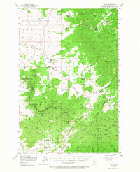
The Coeur d'Alene Indian Reservation dominates the landscape of this 1957 survey, where the rolling transitions between agricultural land and dense forest define the northern panhandle. At the heart of the settlement pattern is Tensed and the nearby De Smet Mission (Indian School), serving as a focal point for the region's cultural and educational life. To the south, the terrain rises significantly toward Mission Mtn and Mineral Mtn, areas largely preserved within the expansive Mary Minerva McCroskey State Park. A ridge-top road known as Skyline Drive follows the high ground, providing a structural axis through the timberlands. Rural life is evidenced by scattered landmarks like the Mtn Home School and the Mtn Home Grange near Cora, illustrating the community-centered layout of Benewah and Latah counties before modern consolidation.
Find a feature on this map
62 named features on this map. Tap any name to fly to it.
Don’t see what you’re looking for? This feature index may not catch every label — zoom into the map to look around manually.
Map Details
Editions of this 1957 Tensed Map
2 editions found
Other maps of this area

1903 · Oakesdale
USGS Topo · 1:125,000

1905 · Oakesdale
USGS Topo · 1:125,000

1910 · Pullman
USGS Topo · 1:125,000

1954 · Fairfield
USGS Topo · 1:62,500

1955 · Pullman
USGS Topo · 1:250,000

1955 · Spokane
USGS Topo · 1:250,000

1957 · St. Maries
USGS Topo · 1:62,500

1957 · Emida
USGS Topo · 1:62,500

1957 · Plummer
USGS Topo · 1:62,500

1958 · Spokane
USGS Topo · 1:250,000