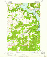
1957 Map of Plummer
USGS Topo · Published 1959About this map
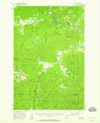
The Coeur D'Alene Lake shoreline dominates the northern landscape of this 1957 field survey, where timbered ridges meet deep-water bays. This area serves as a transition between the northern Coeur D'Alene National Forest and the southern agricultural valleys. The Chicago Milwaukee St Paul And Pacific railroad provides the primary industrial spine, winding through Plummer and Worley before piercing the terrain at the Sorrento Tunnel.
Find a feature on this map
59 named features on this map. Tap any name to fly to it.
Don’t see what you’re looking for? This feature index may not catch every label — zoom into the map to look around manually.
Map Details
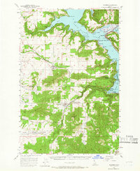
Editions of this 1957 Plummer Map
2 editions found
Other maps of this area

1901 · Spokane
USGS Topo · 1:125,000

1903 · Oakesdale
USGS Topo · 1:125,000

1903 · Rathdrum
USGS Topo · 1:125,000

1905 · Oakesdale
USGS Topo · 1:125,000

1949 · Greenacres
USGS Topo · 1:62,500

1951 · Greenacres
USGS Topo · 1:62,500
1954 · Fairfield
USGS Topo · 1:62,500

1955 · Spokane
USGS Topo · 1:250,000
1957 · St. Maries
USGS Topo · 1:62,500
1957 · Emida
USGS Topo · 1:62,500