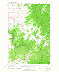
1957 Map of Tensed
USGS Topo · Published 1967About this map
Tensed sits at the heart of this landscape in North Idaho, serving as a hub for the agricultural and timbered lands of the western Palouse. The map reveals a transition from the rolling prairie edges near Hangman Creek and Liberty Butte to the heavily forested ridges of the Coeur d'Alene National Forest. A notable concentration of community life is visible at the southern edge, where the Mtn Home School and Mtn Home Grange stand near the settlement of Cora.
Find a feature on this map
54 named features on this map. Tap any name to fly to it.
Don’t see what you’re looking for? This feature index may not catch every label — zoom into the map to look around manually.
Map Details
Editions of this 1957 Tensed Map
2 editions found
Other maps of this area

1903 · Oakesdale
USGS Topo · 1:125,000

1905 · Oakesdale
USGS Topo · 1:125,000

1910 · Pullman
USGS Topo · 1:125,000

1954 · Fairfield
USGS Topo · 1:62,500

1955 · Pullman
USGS Topo · 1:250,000

1955 · Spokane
USGS Topo · 1:250,000

1957 · St. Maries
USGS Topo · 1:62,500

1957 · Emida
USGS Topo · 1:62,500

1957 · Plummer
USGS Topo · 1:62,500

1957 · Tensed
USGS Topo · 1:62,500