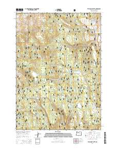
2014 Map of Telephone Butte
USGS Topo · Published 2014About this map
Malhuer National Forest dominates this high-desert terrain in Harney County, where the landscape is defined by its volcanic buttes and critical water sources. Rising above the surroundings, Telephone Butte and King Mountain serve as primary landmarks for navigation through the dense system of forest development roads. Historically significant routes like Military Rd and Fort Harney Rd cross the territory, hinting at the era of early frontier transport and the strategic importance of these passes.
Find a feature on this map
52 named features on this map. Tap any name to fly to it.
Don’t see what you’re looking for? This feature index may not catch every label — zoom into the map to look around manually.
Map Details
Editions of this 2014 Telephone Butte Map
This is the sole edition of this map. No revisions or reprints were ever made.
Other maps of this area

1955 · Burns
USGS Topo · 1:250,000

1958 · Burns
USGS Topo · 1:250,000

1959 · Burns
USGS Topo · 1:250,000
1959 · Harney
USGS Topo · 1:62,500
1961 · Calamity Butte
USGS Topo · 1:62,500
1968 · Van
USGS Topo · 1:62,500
1973 · Buchanan
USGS Topo · 1:24,000
1978 · Stinkingwater Mountains
USGS Topo · 1:100,000
1990 · Calamity Butte
USGS Topo · 1:24,000
1990 · Harney
USGS Topo · 1:24,000