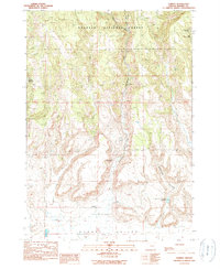
1990 Map of Harney
USGS Topo · Published 1990About this map
Fort Harney (Site) occupies a central position on this landscape where the high desert meets the southern edge of the Malheur National Forest. This transitional zone is defined by the descent from the timbered uplands into the wide Harney Valley. The drainage system is particularly well-defined, showing how Coffeepot Creek, Rattlesnake Creek, and Mill Creek cut through the prominent bluffs.
Find a feature on this map
17 named features on this map. Tap any name to fly to it.
Don’t see what you’re looking for? This feature index may not catch every label — zoom into the map to look around manually.
Map Details
Editions of this 1990 Harney Map
This is the sole edition of this map. No revisions or reprints were ever made.
Other maps of this area

1955 · Burns
USGS Topo · 1:250,000

1958 · Burns
USGS Topo · 1:250,000

1959 · Burns
USGS Topo · 1:250,000

1959 · Harney
USGS Topo · 1:62,500

1961 · Calamity Butte
USGS Topo · 1:62,500

1968 · Van
USGS Topo · 1:62,500

1973 · Buchanan
USGS Topo · 1:24,000

1973 · Carson Point
USGS Topo · 1:24,000

1978 · Stinkingwater Mountains
USGS Topo · 1:100,000
1990 · Ninemile Slough
USGS Topo · 1:24,000