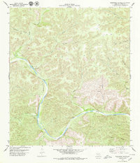
1979 Map of Telephone Canyon
USGS Topo · Published 1979About this map
The Devils River carves a deep, winding path through this corner of Val Verde County, defining a landscape dominated by dramatic relief and remote drainages. In the late 1970s, the area remained largely undeveloped, characterized by a complex network of canyons such as Huffstutler Canyon, Phillips Canyon, and the central Telephone Canyon. Transportation through this steep terrain is limited to a sparse system of Jeep Trails, indicating the area's isolation and use for ranching or recreational access rather than permanent settlement.
Find a feature on this map
20 named features on this map. Tap any name to fly to it.
Don’t see what you’re looking for? This feature index may not catch every label — zoom into the map to look around manually.
Map Details
Editions of this 1979 Telephone Canyon Map
This is the sole edition of this map. No revisions or reprints were ever made.
Other maps of this area

1944 · Dry Devil
USGS Topo · 1:62,500

1944 · Baker Crossing
USGS Topo · 1:62,500

1954 · Sonora
USGS Topo · 1:250,000

1958 · Sonora
USGS Topo · 1:250,000

1958 · Del Rio
USGS Topo · 1:250,000

1964 · Del Rio
USGS Topo · 1:250,000

1970 · Sycamore Canyon
USGS Topo · 1:24,000

1970 · Deaton Draw
USGS Topo · 1:24,000
1973 · White Draw
USGS Topo · 1:24,000
1979 · Dolan Springs
USGS Topo · 1:24,000