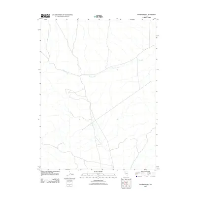
2011 Map of Telephone Well
USGS Topo · Published 2011About this map
Sage Hen Wash winds through this arid expanse of Churchill County, defining the primary drainage pattern of the landscape. The network of unimproved roads and 4WD tracks suggests a region utilized for ranching, land management, or mineral exploration rather than dense settlement. The map provides a clear look at the topography of this high-desert basin, where the watercourses are predominantly ephemeral, carving distinct paths across the valley floor. The sparse distribution of named features highlights the isolated character of the territory surrounding the Telephone Well area.
Find a feature on this map
1 named feature on this map. Tap any name to fly to it.
Don’t see what you’re looking for? This feature index may not catch every label — zoom into the map to look around manually.
Map Details
Editions of this 2011 Telephone Well Map
This is the sole edition of this map. No revisions or reprints were ever made.
Other maps of this area

1886 · Granite Range
USGS Topo · 1:250,000
1890 · Wadsworth
USGS Topo · 1:125,000
1892 · Wadsworth
USGS Topo · 1:125,000

1894 · Granite Range
USGS Topo · 1:250,000
1894 · Wadsworth
USGS Topo · 1:125,000
1908 · Carson Sink
USGS Topo · 1:250,000
1910 · Carson Sink
USGS Topo · 1:250,000

1931 · Lovelock
USGS Topo · 1:250,000

1935 · Lovelock
USGS Topo · 1:250,000
1951 · Desert Peak
USGS Topo · 1:62,500