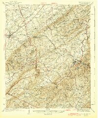
1943 Map of Tellico
USGS Topo · Published 1943About this map
Tellico Plains stands as a focal point in the valley where the Tellico River flows from the Unicoi Mountains. The landscape in the early 1940s is defined by a high density of rural schoolhouses and small community hubs like Englewood and Jalapa, reflecting a period when neighborhood schools such as Manila Sch and Chestuee Sch were the cornerstones of social life. The terrain is marked by the Louisville and Nashville railroad, which follows the lowlands near Wilson Sta, while the more isolated eastern regions fall under the protection of the Cherokee National Forest. Industrial and domestic life are evidenced by several named water-powered sites, including Haun Mill and Harris Mill, and the presence of specialized locations like White Cliff Springs and Holly Springs suggests the value placed on local mineral waters.
Find a feature on this map
86 named features on this map. Tap any name to fly to it.
Don’t see what you’re looking for? This feature index may not catch every label — zoom into the map to look around manually.
Map Details
Editions of this 1943 Tellico Map
2 editions found
Other maps of this area

1886 · Cleveland
USGS Topo · 1:125,000

1887 · Kingston
USGS Topo · 1:125,000

1891 · Kingston
USGS Topo · 1:125,000

1892 · Cleveland
USGS Topo · 1:125,000

1893 · Murphy
USGS Topo · 1:125,000

1893 · Kingston
USGS Topo · 1:125,000

1895 · Cleveland
USGS Topo · 1:125,000

1895 · Loudon
USGS Topo · 1:125,000

1901 · Cleveland
USGS Topo · 1:125,000

1914 · Murphy
USGS Topo · 1:125,000