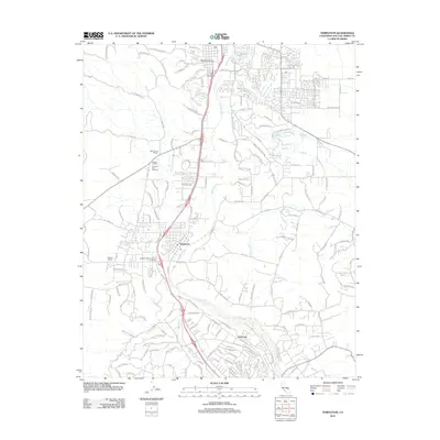
2012 Map of Templeton
USGS Topo · Published 2012About this map
Templeton serves as the central hub of this Central Coast landscape, where the Salinas River winds through a valley defined by viticulture and education. The map illustrates a modern agricultural transition, with numerous established operations like the Creston Manor Vineyard and Winery, Hope Farms Winery, and Peoente Winery interspersed with local landmarks. To the west, the Bethel School Fairview Farm Vineyard reflects the community's blend of historic academic sites and the wine industry.
Find a feature on this map
162 named features on this map. Tap any name to fly to it.
Don’t see what you’re looking for? This feature index may not catch every label — zoom into the map to look around manually.
Map Details
Editions of this 2012 Templeton Map
This is the sole edition of this map. No revisions or reprints were ever made.
Other maps of this area

1897 · San Luis Obispo
USGS Topo · 1:62,500

1897 · Cayucos
USGS Topo · 1:62,500

1900 · San Luis
USGS Topo · 1:125,000

1919 · Paso Robles
USGS Topo · 1:62,500

1919 · Adelaida
USGS Topo · 1:62,500

1932 · Adelaida
USGS Topo · 1:62,500

1937 · Cayucos
USGS Topo · 1:62,500

1942 · Adelaida
USGS Topo · 1:62,500

1942 · San Luis Obispo
USGS Topo · 1:62,500

1943 · Paso Robles
USGS Topo · 1:62,500