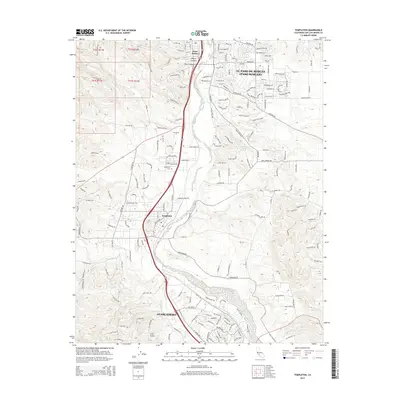
2015 Map of Templeton
USGS Topo · Published 2015About this map
The Salinas River corridor defines the geography of this Central Coast landscape, anchoring the connected communities of Paso Robles, Templeton, and Atascadero. This 2015 survey details the established residential and agricultural grids of northern San Luis Obispo County, where the river's path is paralleled by El Camino Real. The terrain varies from the level valley floors along Paso Robles Creek to the undulating ridgelines of Peachy Canyon and Kiler Canyon in the west. Local history and genealogy interests are served by the location of the Templeton Cemetery and numerous family-named landmarks. The map also documents essential water sources in the semi-arid hills, including Sulphur Spring and Neals Spring, along with the network of rural routes like Santa Rita Road and Templeton Road that link the vineyards and ranches to the primary settlements.
Find a feature on this map
31 named features on this map. Tap any name to fly to it.
Don’t see what you’re looking for? This feature index may not catch every label — zoom into the map to look around manually.
Map Details
Editions of this 2015 Templeton Map
This is the sole edition of this map. No revisions or reprints were ever made.
Other maps of this area

1897 · San Luis Obispo
USGS Topo · 1:62,500

1897 · Cayucos
USGS Topo · 1:62,500

1900 · San Luis
USGS Topo · 1:125,000

1919 · Paso Robles
USGS Topo · 1:62,500

1919 · Adelaida
USGS Topo · 1:62,500

1932 · Adelaida
USGS Topo · 1:62,500

1937 · Cayucos
USGS Topo · 1:62,500

1942 · Adelaida
USGS Topo · 1:62,500

1942 · San Luis Obispo
USGS Topo · 1:62,500

1943 · Paso Robles
USGS Topo · 1:62,500