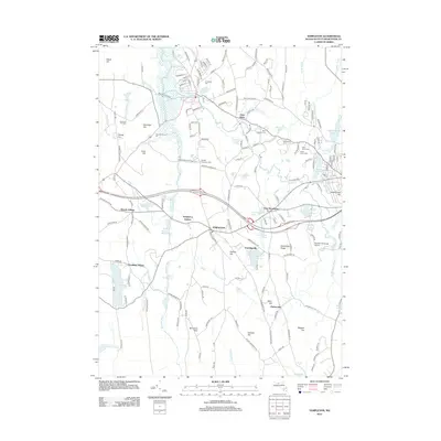
2012 Map of Templeton
USGS Topo · Published 2012About this map
Templeton and its satellite villages of East Templeton and Otter River define the local topography, where water resources like the Burnshirt River and Otter River shaped early development. The landscape is dotted with small settlements such as Brooks Village, Goulding Village, and Pitcherville, alongside the industrial and transportation hub at Templeton Station. Local history is preserved through a significant collection of cemeteries, including Greenlawn Cem, Saint Josephs Cem, and Wildwood Cem, reflecting the diverse community heritage of the area. Significant natural and recreational features include the Templeton State Frst and several prominent hills like Mine Hill and Burnshirt Hills. The map also captures the modern infrastructure of the Gardner Municipal Airport and the expansive Queen Lake to the southwest, illustrating the region's balance of wooded highlands and established residential centers.
Find a feature on this map
170 named features on this map. Tap any name to fly to it.
Don’t see what you’re looking for? This feature index may not catch every label — zoom into the map to look around manually.
Map Details
Editions of this 2012 Templeton Map
This is the sole edition of this map. No revisions or reprints were ever made.
Other maps of this area

1885 · Worcester
USGS Topo · 1:62,500

1886 · Worcester
USGS Topo · 1:62,500

1887 · Winchendon
USGS Topo · 1:62,500

1887 · Barre
USGS Topo · 1:62,500

1887 · Fitchburg
USGS Topo · 1:62,500

1889 · Fitchburg
USGS Topo · 1:62,500

1889 · Barre
USGS Topo · 1:62,500

1890 · Winchendon
USGS Topo · 1:62,500

1892 · Worcester
USGS Topo · 1:62,500

1893 · Fitchburg
USGS Topo · 1:62,500