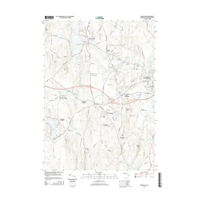
2015 Map of Templeton
USGS Topo · Published 2015About this map
Baldwinville and Otter River anchor the northern landscape of this Worcester County survey, where the Otter River and its numerous tributaries dictate the placement of industry and transport. The area is defined by a series of distinct villages including East Templeton, Partridgeville, and Brooks Village, many connected by the historical rail path through Templeton Station. To the west, the expansive waters of Queen Lake and Stone Bridge Pond suggest a transition into a more recreational or seasonal character, while the eastern edge is dominated by the growth of Gardner and its infrastructure, such as the Gardner Municipal Airport. Local history is deeply embedded in the terrain at Mine Hill and through a remarkably dense concentration of burial grounds, from the small Norcross Hill Cem to the larger Wildwood Cem. The map reveals a sophisticated network of water management, evidenced by the Perley Brook Reservoir and Otter River Reservoir.
Find a feature on this map
177 named features on this map. Tap any name to fly to it.
Don’t see what you’re looking for? This feature index may not catch every label — zoom into the map to look around manually.
Map Details
Editions of this 2015 Templeton Map
This is the sole edition of this map. No revisions or reprints were ever made.
Other maps of this area

1885 · Worcester
USGS Topo · 1:62,500

1886 · Worcester
USGS Topo · 1:62,500

1887 · Winchendon
USGS Topo · 1:62,500

1887 · Barre
USGS Topo · 1:62,500

1887 · Fitchburg
USGS Topo · 1:62,500

1889 · Fitchburg
USGS Topo · 1:62,500

1889 · Barre
USGS Topo · 1:62,500

1890 · Winchendon
USGS Topo · 1:62,500

1892 · Worcester
USGS Topo · 1:62,500

1893 · Fitchburg
USGS Topo · 1:62,500