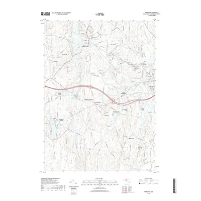
2018 Map of Templeton
USGS Topo · Published 2018About this map
The Otter River corridor serves as the industrial and settlement backbone of this central Massachusetts landscape, connecting the villages of Baldwinville, Otter River, and East Templeton. The area is characterized by a high concentration of institutional landmarks, particularly cemeteries such as Greenlawn Cem, Saint Josephs Cem, and Wildwood Cem, which reflect the long-standing community roots in Worcester County. The Pan Am Southern railroad line parallels the river, tracing the same path that historically fueled the development of local manufacturing centers like Partridgeville and Goulding Village. To the southeast, the Gardner Municipal Airport sits near the headwaters of Pond Brook, illustrating the modern transition of land use. Significant terrain features including Mine Hill and Ragged Hill rise above the wetlands and river valleys, providing a clear view of the complex hydrography formed by Queen Lake and the Burnshirt River.
Find a feature on this map
176 named features on this map. Tap any name to fly to it.
Don’t see what you’re looking for? This feature index may not catch every label — zoom into the map to look around manually.
Map Details
Editions of this 2018 Templeton Map
This is the sole edition of this map. No revisions or reprints were ever made.
Other maps of this area

1885 · Worcester
USGS Topo · 1:62,500

1886 · Worcester
USGS Topo · 1:62,500

1887 · Winchendon
USGS Topo · 1:62,500

1887 · Barre
USGS Topo · 1:62,500

1887 · Fitchburg
USGS Topo · 1:62,500

1889 · Fitchburg
USGS Topo · 1:62,500

1889 · Barre
USGS Topo · 1:62,500

1890 · Winchendon
USGS Topo · 1:62,500

1892 · Worcester
USGS Topo · 1:62,500

1893 · Fitchburg
USGS Topo · 1:62,500