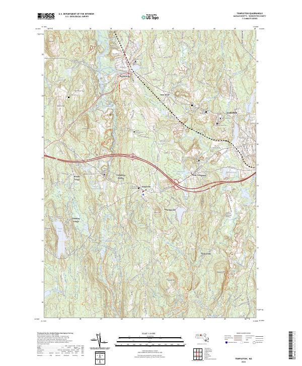
2024 Map of Templeton
USGS Topo · Published 2024About this map
Baldwinville and Otter River anchor the northern landscape of this Worcester County region, where the industrial and transport history of the Blackstone Valley's northern reaches remains visible. The presence of the Ware River Valley Rail Trl reflects the enduring path of former rail corridors that once connected these manufacturing villages. The terrain is defined by a series of prominent rises including Norcross Hill, Church Hill, and Crow Hill, which channel the flow of the Burnshirt River and the Otter River.
Find a feature on this map
181 named features on this map. Tap any name to fly to it.
Don’t see what you’re looking for? This feature index may not catch every label — zoom into the map to look around manually.
Map Details
Editions of this 2024 Templeton Map
This is the sole edition of this map. No revisions or reprints were ever made.
Other maps of this area

1885 · Worcester
USGS Topo · 1:62,500

1886 · Worcester
USGS Topo · 1:62,500

1887 · Winchendon
USGS Topo · 1:62,500

1887 · Barre
USGS Topo · 1:62,500

1887 · Fitchburg
USGS Topo · 1:62,500

1889 · Fitchburg
USGS Topo · 1:62,500

1889 · Barre
USGS Topo · 1:62,500

1890 · Winchendon
USGS Topo · 1:62,500

1892 · Worcester
USGS Topo · 1:62,500

1893 · Fitchburg
USGS Topo · 1:62,500