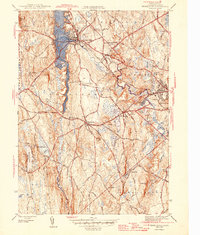
1946 Map of Templeton
USGS Topo · Published 1946About this map
Baldwinsville and the surrounding villages of Templeton and East Templeton form a dense network of industrial and institutional life at the close of World War II. The Otter River winds through the landscape, supporting the Otter River settlement and connecting the region's productive centers. This map reveals a significant concentration of state and social infrastructure, including the expansive Fernald State School near Norcross Hill, as well as the Hospital Cottages and an Infirmary.
Find a feature on this map
50 named features on this map. Tap any name to fly to it.
Don’t see what you’re looking for? This feature index may not catch every label — zoom into the map to look around manually.
Map Details
Editions of this 1946 Templeton Map
2 editions found
Other maps of this area

1885 · Worcester
USGS Topo · 1:62,500

1886 · Worcester
USGS Topo · 1:62,500

1887 · Winchendon
USGS Topo · 1:62,500

1887 · Barre
USGS Topo · 1:62,500

1887 · Fitchburg
USGS Topo · 1:62,500

1889 · Fitchburg
USGS Topo · 1:62,500

1889 · Barre
USGS Topo · 1:62,500

1890 · Winchendon
USGS Topo · 1:62,500

1892 · Worcester
USGS Topo · 1:62,500

1893 · Fitchburg
USGS Topo · 1:62,500