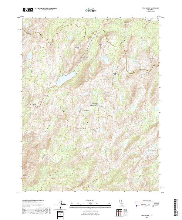
2021 Map of Tenaya Lake
USGS Topo · Published 2021About this map
Tenaya Lake and the high peaks of the Cathedral Range dominate this high-elevation wilderness within Yosemite National Park. The landscape is defined by massive granite features including Polly Dome, Pywiack Dome, and the prominent Clouds Rest. Transport and passage are marked by historic corridors such as the Old Tioga Road Trl and the world-renowned John Muir Trl, which traverses the eastern half of the map through Cathedral Pass. Numerous alpine water bodies, including the Cathedral Lakes and May Lake, are distributed among the peaks, feeding into systems like Tenaya Creek and the dramatic Tenaya Canyon. This survey illustrates the intricate drainage patterns of the Sierra Nevada before these waters descend toward the valley floor, showing the relation between glacial basins like Long Meadow and the surrounding granite summits.
Find a feature on this map
53 named features on this map. Tap any name to fly to it.
Don’t see what you’re looking for? This feature index may not catch every label — zoom into the map to look around manually.
Map Details
Editions of this 2021 Tenaya Lake Map
This is the sole edition of this map. No revisions or reprints were ever made.
Other maps of this area

1897 · Yosemite
USGS Topo · 1:125,000

1900 · Yosemite
USGS Topo · 1:125,000

1901 · Mt. Lyell
USGS Topo · 1:125,000

1903 · Yosemite
USGS Topo · 1:125,000

1909 · Yosemite
USGS Topo · 1:125,000

1947 · Mariposa
USGS Topo · 1:250,000

1948 · Mariposa
USGS Topo · 1:250,000

1953 · Merced Peak
USGS Topo · 1:62,500

1956 · Hetch Hetchy Reservoir
USGS Topo · 1:62,500

1956 · Tuolumne Meadows
USGS Topo · 1:62,500