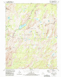
1990 Map of Tenaya Lake
USGS Topo · Published 1990About this map
Tioga Road winds through this high-country landscape, providing the primary access to the granite-dominated heart of Yosemite National Park. This 1990 edition illustrates a carefully managed wilderness environment where designated recreation sites like the Tenaya Lake Campground and May Lake High Sierra Camp sit alongside deep backcountry routes. The map documents the intricate network of footpaths, including the legendary John Muir Trail as it traverses the Cathedral Range. From the heights of Clouds Rest to the dramatic depths of Tenaya Canyon, the survey captures the complex drainage patterns of Tenaya Creek and Cathedral Creek. Notable landmarks like Olmsted Point and the prominent Pywiack Dome serve as key navigational markers for explorers of the Yosemite Wilderness.
Find a feature on this map
54 named features on this map. Tap any name to fly to it.
Don’t see what you’re looking for? This feature index may not catch every label — zoom into the map to look around manually.
Map Details
Editions of this 1990 Tenaya Lake Map
This is the sole edition of this map. No revisions or reprints were ever made.
Other maps of this area

1897 · Yosemite
USGS Topo · 1:125,000

1900 · Yosemite
USGS Topo · 1:125,000

1901 · Mt. Lyell
USGS Topo · 1:125,000

1903 · Yosemite
USGS Topo · 1:125,000

1909 · Yosemite
USGS Topo · 1:125,000

1947 · Mariposa
USGS Topo · 1:250,000

1948 · Mariposa
USGS Topo · 1:250,000

1953 · Merced Peak
USGS Topo · 1:62,500

1956 · Hetch Hetchy Reservoir
USGS Topo · 1:62,500

1956 · Tuolumne Meadows
USGS Topo · 1:62,500