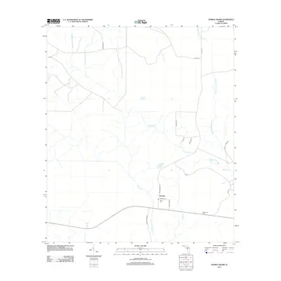
2012 Map of Tenmile Swamp
USGS Topo · Published 2012About this map
The settlement of Wetappo sits at the heart of this coastal lowland landscape, characterized by the intricate drainage of Tenmile Swamp. The hydrology of the region is defined by the W Fork Tenmile Swamp and E Fork Tenmile Swamp, which feed into a network of creeks and branches like Stone Mill Cr and Wetappo Cr. These watercourses have historically shaped movement and settlement in this part of Florida, as evidenced by the corridor of local roads and family-named landmarks.
Find a feature on this map
26 named features on this map. Tap any name to fly to it.
Don’t see what you’re looking for? This feature index may not catch every label — zoom into the map to look around manually.
Map Details
Editions of this 2012 Tenmile Swamp Map
This is the sole edition of this map. No revisions or reprints were ever made.
Other maps of this area

1945 · Dead Lake
USGS Topo · 1:31,680

1945 · Youngstown
USGS Topo · 1:31,680

1945 · Broad Branch
USGS Topo · 1:31,680

1945 · Allanton
USGS Topo · 1:31,680

1945 · North Of Allanton
USGS Topo · 1:31,680

1945 · Frink
USGS Topo · 1:31,680

1945 · Wewahitchka
USGS Topo · 1:31,680

1945 · Wetappo Creek
USGS Topo · 1:31,680

1945 · Tenmile Swamp
USGS Topo · 1:31,680

1947 · Allanton
USGS Topo · 1:25,000