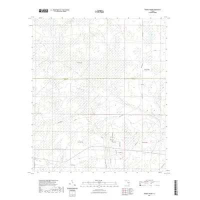
2021 Map of Tenmile Swamp
USGS Topo · Published 2021About this map
Tenmile Swamp dominates this landscape along the border of Calhoun and Gulf counties in the Florida panhandle. This low-lying drainage system is defined by a complex network of wetlands and creek systems, including the W Fork and E Fork, which feed into the broader Wetappo Swamp. The terrain is punctuated by slightly higher elevations like Two Pen Ridge, providing dry ground for a sparse network of forest roads and small family landmarks. Local history is anchored at the Wetappo Cem and Kemp Cem, located near the intersection of Kemp Cemetery Rd and Pippin Rd. Further south, Wetappo Cr and Stone Mill Creek meander through the pines, reflecting a region deeply tied to its hydrological patterns and timber-access routes like Longleaf road.
Find a feature on this map
50 named features on this map. Tap any name to fly to it.
Don’t see what you’re looking for? This feature index may not catch every label — zoom into the map to look around manually.
Map Details
Editions of this 2021 Tenmile Swamp Map
This is the sole edition of this map. No revisions or reprints were ever made.
Other maps of this area

1945 · Dead Lake
USGS Topo · 1:31,680

1945 · Youngstown
USGS Topo · 1:31,680

1945 · Broad Branch
USGS Topo · 1:31,680

1945 · Allanton
USGS Topo · 1:31,680

1945 · North Of Allanton
USGS Topo · 1:31,680

1945 · Frink
USGS Topo · 1:31,680

1945 · Wewahitchka
USGS Topo · 1:31,680

1945 · Wetappo Creek
USGS Topo · 1:31,680

1945 · Tenmile Swamp
USGS Topo · 1:31,680

1947 · Allanton
USGS Topo · 1:25,000