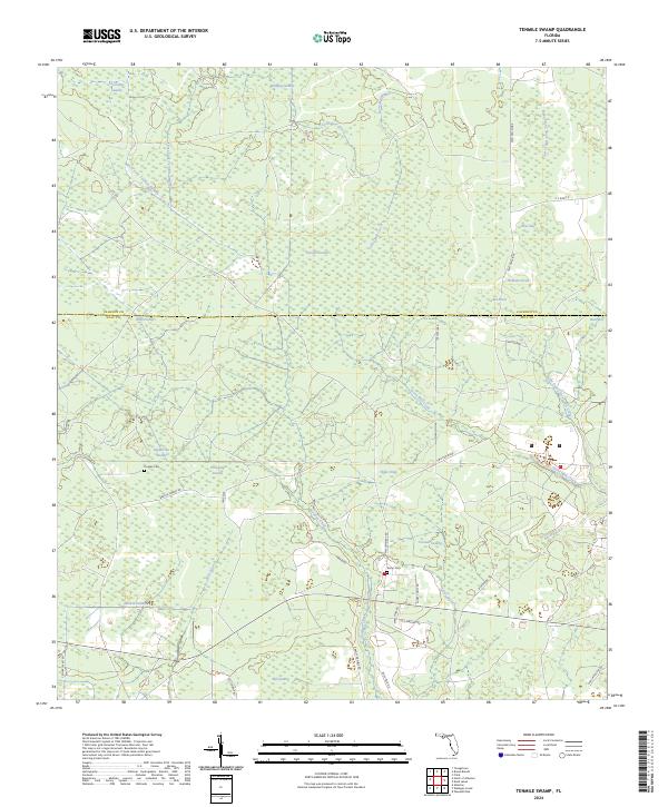
2024 Map of Tenmile Swamp
USGS Topo · Published 2024About this map
Tenmile Swamp dominates the center of this Florida landscape, where a dense network of wetlands and creeks defines the local geography. The map shows the transition from the low-lying Wetappo Swamp and Green-Bay Swamp in the north to the flowing waters of Wetappo Creek further south. This area is characterized by a series of named "bays" and "swamps," such as Walford Bay and Wildcat Swamp, which suggest a topography where water flow is dictated by subtle elevation changes along Two Pen Ridge.
Find a feature on this map
48 named features on this map. Tap any name to fly to it.
Don’t see what you’re looking for? This feature index may not catch every label — zoom into the map to look around manually.
Map Details
Editions of this 2024 Tenmile Swamp Map
This is the sole edition of this map. No revisions or reprints were ever made.
Other maps of this area

1945 · Dead Lake
USGS Topo · 1:31,680

1945 · Youngstown
USGS Topo · 1:31,680

1945 · Broad Branch
USGS Topo · 1:31,680

1945 · Allanton
USGS Topo · 1:31,680

1945 · North Of Allanton
USGS Topo · 1:31,680

1945 · Frink
USGS Topo · 1:31,680

1945 · Wewahitchka
USGS Topo · 1:31,680

1945 · Wetappo Creek
USGS Topo · 1:31,680

1945 · Tenmile Swamp
USGS Topo · 1:31,680

1947 · Allanton
USGS Topo · 1:25,000