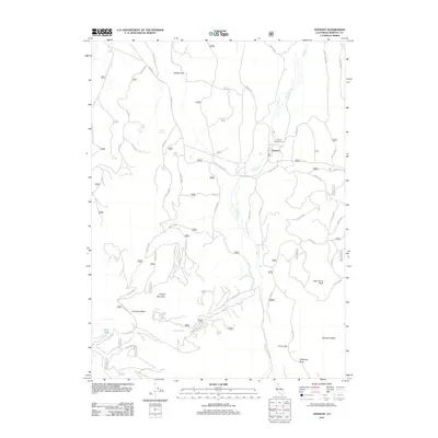
2012 Map of Tennant
USGS Topo · Published 2012About this map
Tennant and the surrounding high-altitude terrain of Siskiyou County define this corner of Northern California. The landscape is marked by prominent volcanic peaks and ridges, including Haight Mountain, Little Horse Peak, and Stephens Butte. A network of Forest Service roads, such as Tennant Rd and Long Prairie Rd, provides access through the timbered flats and volcanic slopes. The hydrology of the area is centered on Antelope Cr, which flows north toward Pollock Flat. Natural water sources like Cold Spring, Blue Spring, and Duck Lake serve as critical landmarks in this high-country environment. The presence of the Tennant Campground and the Old State Hwy suggests the area’s role in recreation and regional transit within the national forest system.
Find a feature on this map
36 named features on this map. Tap any name to fly to it.
Don’t see what you’re looking for? This feature index may not catch every label — zoom into the map to look around manually.
Map Details
Editions of this 2012 Tennant Map
This is the sole edition of this map. No revisions or reprints were ever made.
Other maps of this area

1886 · Modoc Lava Bed
USGS Topo · 1:250,000

1886 · Shasta
USGS Topo · 1:250,000

1892 · Modoc Lava-Bed
USGS Topo · 1:250,000

1894 · Shasta
USGS Topo · 1:250,000

1932 · Bartle
USGS Topo · 1:96,000

1934 · Macdoel
USGS Topo · 1:96,000

1935 · Dunsmuir
USGS Topo · 1:125,000

1939 · Bartle
USGS Topo · 1:125,000

1941 · Macdoel
USGS Topo · 1:125,000

1948 · Weed
USGS Topo · 1:250,000