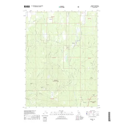
2018 Map of Tennant
USGS Topo · Published 2018About this map
Tennant lies at the intersection of high-elevation forestry and volcanic terrain, where the northern reaches of the Shasta National Forest meet the Klamath National Forest. The landscape is defined by massive relief features such as Haight Mtn and Stephens Butte, alongside the prominent Picadilly Ridge. An extensive network of Forest Service and logging roads, including the Tennant Rd and Long Prairie Rd, crisscrosses the timberlands. Notable water sources such as Blue Spring, Cold Spring, and Duck Lake provide vital hydrology in a region shaped by its proximity to Antelope Creek. A distinct Railroad Grade running through the eastern portion of the map points to the area's legacy of industrial timber extraction, connecting the settlement of Tennant to the broader Pacific Northwest rail network.
Find a feature on this map
70 named features on this map. Tap any name to fly to it.
Don’t see what you’re looking for? This feature index may not catch every label — zoom into the map to look around manually.
Map Details
Editions of this 2018 Tennant Map
This is the sole edition of this map. No revisions or reprints were ever made.
Other maps of this area

1886 · Modoc Lava Bed
USGS Topo · 1:250,000

1886 · Shasta
USGS Topo · 1:250,000

1892 · Modoc Lava-Bed
USGS Topo · 1:250,000

1894 · Shasta
USGS Topo · 1:250,000

1932 · Bartle
USGS Topo · 1:96,000

1934 · Macdoel
USGS Topo · 1:96,000

1935 · Dunsmuir
USGS Topo · 1:125,000

1939 · Bartle
USGS Topo · 1:125,000

1941 · Macdoel
USGS Topo · 1:125,000

1948 · Weed
USGS Topo · 1:250,000